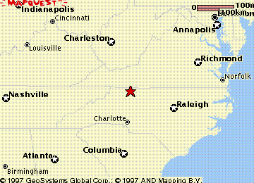
Surry County, North Carolina
Joseph Cloud, Jr. settled in the southern part of Henry County, Virginia just across the line from the grants he later received in Surry County, North Carolina. He purchased land in Rowan County (later Surry County), North Carolina in 1755. It appears that he died in North Carolina in either Surry or Stokes County.
Surry County was formed in 1771 from Rowan County, and was named for the county of Surry, England, birthplace of the incumbent Governor, William Tryon. Surry County initially included the entire northwest corner of North Carolina. Wilkes County was split off in 1778 and later gave rise to Ashe, Alleghany, and Watauga. Stokes County was formed from Surry in 1789 and in 1849 gave rise to Forsyth. What remained of Surry was split into Yadkin and present day Surry in 1850.
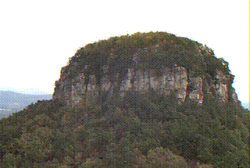
Pilot Mountain in Surry County, North Carolina
Obtaining a land grant involved these steps: land entry, land warrant, plat of survey, and grant. The prospective landowner first found the land he or she wanted and then made application with the land office. The application was called "land entry". The claims were entered by the claimant except in the following cases:
(1) A guardian who claimed for an orphan child
(2) Persons absent in the service of North Carolina or the United States
The person entering the claim told the entry taker how large the tract of land was and gave a description of the land including the name of the waterway it was located on. The act specified that these persons receiving grants of land were to be "industrious persons". Upon receiving the entry application, the entry taker transcribed the land entry into a land entry book. In cases where duplicate claims for the same land were made, a caveat was filed by one of the parties in the Secretary of States office. The caveat prevented the grant from being made until a hearing was held. The entry taker made a notation in the margin of the entry book opposite the disputed claim. Also a copy was sent to the county court which decided whose claim would be received. The claimant paid the necessary fees, and the land warrant was issued by the Secretary of State or county entry taker. The land warrant simply authorized the County Surveyor to set aside the land vaguely described in the land entry. Surveys could not be made without "chain carriers", who actually measured the land being surveyed. After surveying the land, the surveyor sent two copies of the plat of survey to the Secretary of State.
After the plat of survey had been received and all necessary fees had been paid, the Secretary of State recorded the grant. The claimant then registered his land grant with the Register of Deeds in the county where the land was located. It is important to mention here that not all persons making land entries actually ever received deeds to the land. A claim may have already been made on the entry. In other cases some persons entering claims may have "gotten the fever" to move on westward.
Fees were paid to entry takers, surveyors, registers, and the Secretary. The act passed in 1777 set fees as follows:
(1) Entry taker (all services) 16 shillings
(2) Surveyor for every 300 acres or less 30 shillings
for every 100 acres more 3 shillings
(3) Secretary (for making out and recording the grant) 5 shillings
(4) Governor's Secretary (for the Great Seal) 3 shillings
Go to: